
Not only are there over 350 customizable maps, but there are tons of wonderful ideas on how to use the maps with your children in the Teacher Notes section. These great hands-on ideas for learning geography cover five themes:
1. location
2. place
3. relationship within places
4. movement
5. regions
The Teacher Notes also includes fifty ideas for using the maps. Some of my favorite suggestions and ones I will soon be incorporating with our current studies are:
-locating and labeling the birthplace of the world's most famous composers--we'll include that as part of our composers studies
-locating and labeling the countries of service of missionaries--currently we are studying Asia and are reading many biographies of missionaries throughout Asia during the last 200+ years
-using maps as book logs by labeling the setting of a book on the map
-using purchased themed stickers to label the animals of the world, national and world landmarks and so much more--How much fun would this be for the K-3 grade students!
The maps themselves are divided into four sections:
1. The World Continents, Regions, Nations
2. United States of America
3. Historical Maps
4. Thematic Maps
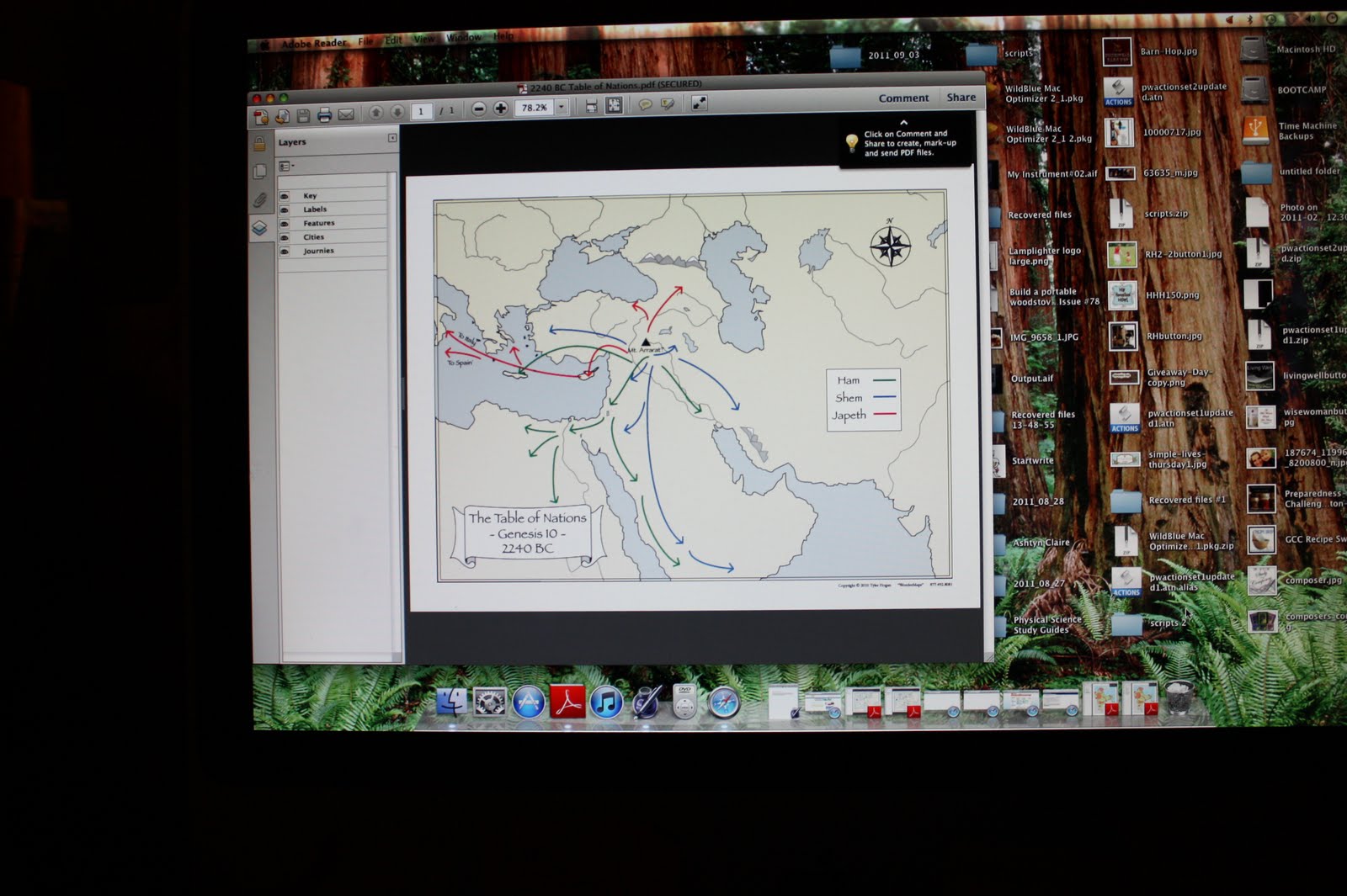
This map shows the movements of Noah's descendants throughout the world.

Side by side maps comparing English occupancy of India from 1735-1858
As I have been studying the WonderMaps program I have come up with some great ways to use it with my children. Not only can I print out maps, but I can also determine what I will show on the maps using the nifty layering tool. Borders, rivers, cities, country names, map key and so much more can be added or deleted as needed. I can print out a blank map in black and white with just the borders and have my children label each country. I can add in the rivers and other features and even use color. The historical maps also feature a modern overlay which depicts today's boundaries. I find that I can show two maps on my screen at the same time to depict the changes in Europe from before and after both World Wars, which just happens to be the time period we are studying right now.

Comparing Europe at the end of World War I to the end of World War II
WonderMaps software collection will be an invaluable tool for us as we make our way through time and across the world. Browse the Timberdoodle on-line catalog here or request a copy through the mail. We have enjoyed purchasing much of our homeschooling materials through Timberdoodle for at least 20 years now and have always received prompt and quality service.
And, finally, as a member of Timberdoodle's Blogger Review Team I received a copy of WonderMaps for my frank and unbiased review.
 |
| http://www.hiphomeschoolmoms.com/2011/09/hip-homeschool-hop-91311/ |
1 comment:
Great review! I've been thinking about purchasing this. Glad to hear all the good things about it.
Post a Comment